Save items you love by
clicking the heart icon next
to them!


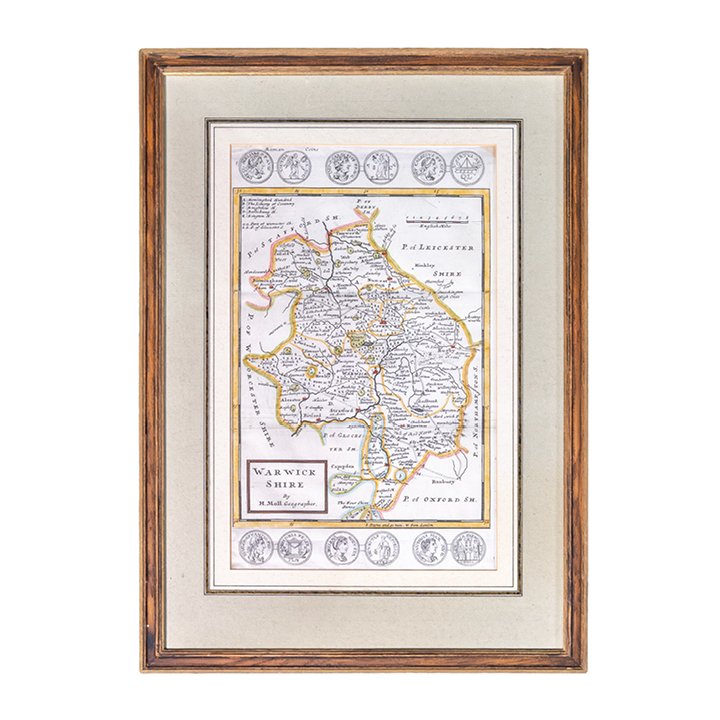
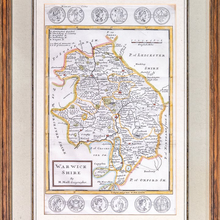
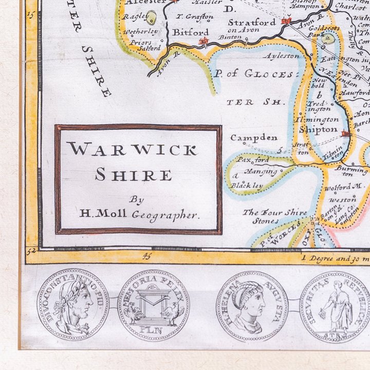

Map of Warwickshire from A New Description of England and Wales
EUR 24
This item is reserved
-
 Delivery:1 to 5 days within the UAE, depending on the size of the object and the location to be delivered to.
-

About
Framed, hand-coloured engraved map of Warwickshire from "A New Description of England and Wales" by Herman Moll, published in London, 1724. The map depicts the county with roads, towns, rivers, and regional divisions, bordered by medallion illustrations of coins and heraldic devices. Title cartouche lower left. Presented in a later wooden frame with neutral mount. Preserved in very good antique condition, patina on the surface due to natural aging.
Herman Moll (c.1654–1732) was a German-born cartographer and engraver active in London during the late 17th and early 18th centuries. He became one of the most prominent mapmakers in Britain. Among his works: atlases, regional surveys, and engraved maps known for their clarity and decorative detail. His "A New Description of England and Wales," first published in the early 18th century, included detailed county maps combining geography, road networks, antiquarian references, and historical ornament.
Item Details
-
CreatorHerman Moll
-
DimensionsH 46.5 cm x W 33 cm x D 2 cm
-
Weight0.3 kg
-
Place of originEngland
-
ConditionVery GoodPackageBubble Wrap
-
Period / Date1724
-
Materials & TechniquesBook Page - Engraved Print - Hand-Colored
Returns, Payment Methods & Product Profile
-
Returns & Refunds

-
Payment Methods

-
Product Profile

-
Stay Inspired
-